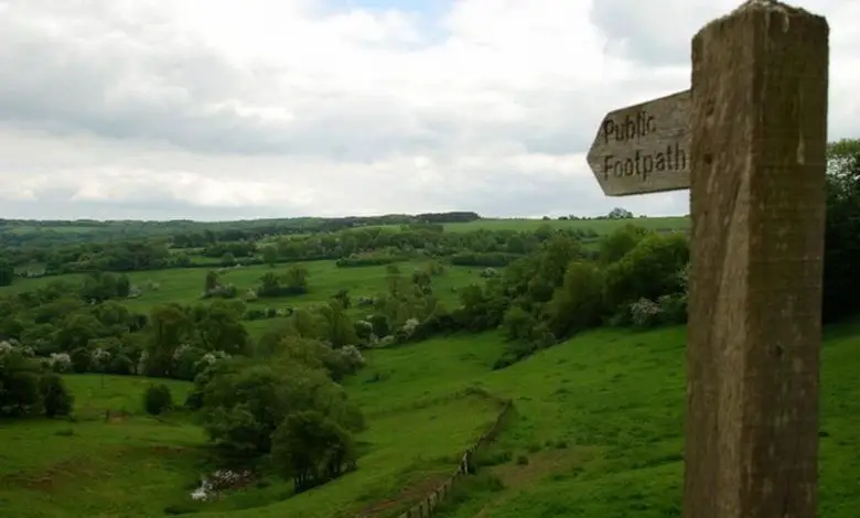
“You can have adventures with wheels,” says the Disabled Ramblers Association. Members of the group are compiling a collection of accessible and exciting routes for the ViewRanger GPS navigation app, so everyone can share and follow the routes using a smartphone or tablet.
ViewRanger was developed by two outdoor enthusiasts who were brought up on the Walking with Wainright trail guides, which have hand drawn images of the fells and mountains along with detailed descriptions of the routes. Working in the computer industry, they felt there was an opportunity to make this level of information available digitally.
Co-founder Craig Wareham explains: “We wanted to make the countryside more accessible. People often keep to the same familiar routes as they are concerned about getting lost or that the trail might be too long or difficult for them. Within the ViewRanger app we have compiled an extensive guide of routes that have been recommended by travel publishers and individuals.
We encourage those submitting the routes to include as much detail as possible about points of interest, things to see on the way and photographs where possible to encourage others to explore.”
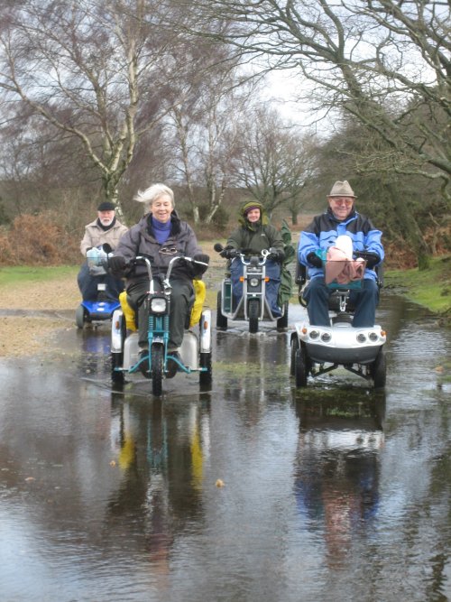
Among the many groups recommending routes is the Disabled Ramblers Association. The charity’s members use off-road motorised scooters called Trampers to climb hills, cross streams and navigate muddy trails. They grade the routes so that others can select one that is suitable for their abilities and their type of wheeled vehicle.
Rambles organiser John Cuthbertson finds and explores about 30 rambles a year around England and Wales and uploads the best into ViewRanger.
He says: “Finding suitable routes is a time consuming job which can be frustrating when promising rambles are blocked by steps, stiles, narrow bridges and locked gates.”
Founder Craig agrees: “Talking to our users we have realised that many groups have similar issues with access, such as parents with baby carriers or buggies who have problems with stiles. So we have included a new category within ViewRanger called Walking with Wheels.
By creating the feature we are hoping to make everyone consider access when they are recommending routes, so it is easier for mobility challenged ramblers to find outdoor routes that are suitable for wheelchairs and powered chairs.”
John welcomes this new category. He says: “Having a store of suitable routes on ViewRanger will make it much easier for all people with mobility limitations, whether they are on mobility scooters, pushing child buggies or just have difficulty climbing stiles, to find a good trail.”
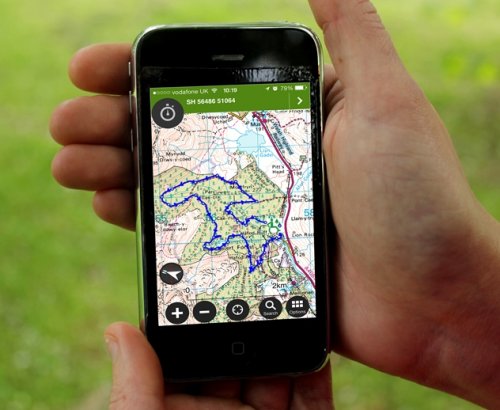
Having extra information upfront can help make the day more enjoyable. ViewRanger also works as an off-road sat nav which can be used to keep you on the right path.
The ViewRanger app is free to download and many of the routes, such as those created by the Disabled Ramblers Association, are free. These can be viewed on a mobile device overlaid on an outline map. It is also possible to download more detailed Ordnance Survey mapping so that you always have a good quality map in your pocket, via the ViewRanger app.
Top tips for using ViewRanger
- Download the app, as well as any routes and maps you might need, onto your mobile device before setting off. This allows you to view the map, route and your location without the need for a mobile signal.
- Use the ‘search for routes’ feature within the app to find some routes that look suitable for you. Check the length and difficulty and view the route on a map. Many of the routes provided by organisations such as the New Forest National Park Authority, give detailed access information.
- Download a number of routes to your phone before you go so that you will have a choice when you arrive.
- Make sure your smartphone is fully charged and close down any apps you do not need to extend the battery life. Turn off Bluetooth and Wifi if you do not need them.
- If you have favourite routes that you think others would enjoy set the ‘record track’ option when you next go. Your GPS will record the route you take and when you get home you can sync the route with my.viewranger.com and add photographs and notes about any good cafés, pubs, the location of public toilets and other useful information.
- Don’t forget to highlight any access issues on the route such as stiles, kissing gates or steps.
To view some of the recently shared routes, suitable for those with access or mobility issues, go to: my.viewranger.com/user/details/30097
By Samantha Dalton
Check out…
• Accessible Britain: a one-stop-shop for accessible travel information
• Top accessible walks in Yorkshire
• Accessible travel in Europe: the day is coming
Have you used this app or do you have experiences of using similar accessible walking tools? Get in touch by messaging us on Facebook, tweeting us @DHorizons, emailing us at editor@disabilityhorizons.com or leaving your comments below.